Microdrones md4-3000
by Microdrones
Overview
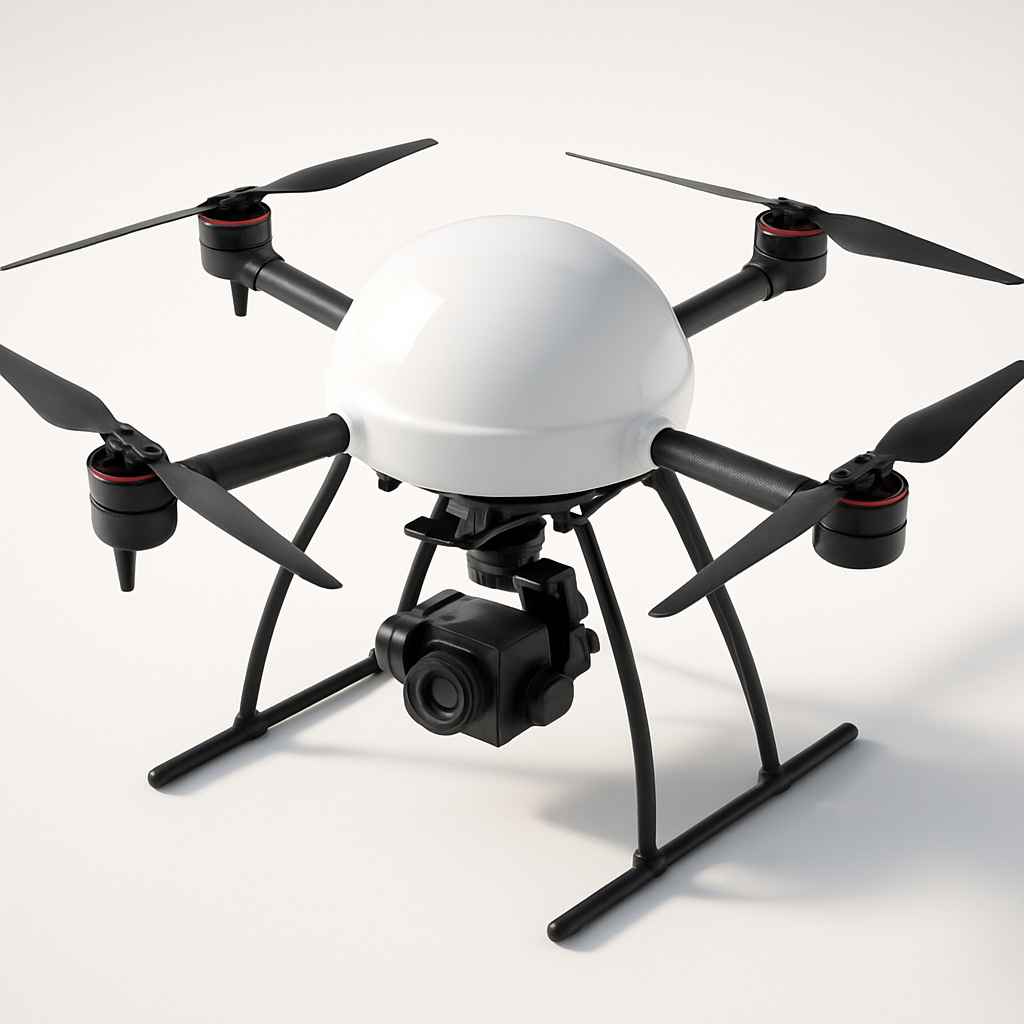
The Microdrones md4-3000 represents a mature approach to professional UAV operations, specifically engineered for surveying, mapping, and industrial inspection applications. As part of Microdrones' well-established lineup, this quadcopter platform has been refined through years of commercial deployment across various industries including construction, mining, agriculture, and infrastructure inspection.
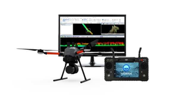
Built with modularity at its core, the md4-3000 allows operators to quickly swap between different sensor payloads depending on mission requirements. This flexibility, combined with its weatherproof construction and professional-grade flight planning software, positions it as a reliable workhorse for organizations requiring consistent, high-quality aerial data collection. The system integrates seamlessly with established GIS workflows and provides the kind of repeatability that commercial operators demand.
The md4-3000 stands out in the crowded commercial drone market through its emphasis on operational reliability rather than cutting-edge specifications. While newer platforms may offer longer flight times or higher payloads, Microdrones has focused on creating a system that performs consistently in real-world conditions, backed by comprehensive training programs and technical support.
Key Specifications
- Maximum flight time: 45 minutes (payload dependent)
- Maximum payload: 1.2 kg
- Operating wind speed: Up to 12 m/s (27 mph)
- Maximum speed: 18 m/s (40 mph)
- Operating altitude: Up to 4,500 m above sea level
- GPS accuracy: RTK capability with centimeter-level precision
- IP rating: IP54 (weather resistant)
- Operating temperature: -20°C to +50°C
- Takeoff weight: 5.5 kg (including battery)
- Rotor diameter: 4 rotors, 380mm each
- Communication range: Up to 3 km line of sight
- Battery: Hot-swappable lithium polymer
- Ground control: mdCockpit software with mission planning
- Sensor compatibility: RGB cameras, multispectral, LiDAR, thermal imaging
- Certification: Designed for commercial operations compliance
- Landing system: Precision auto-landing capability
Pricing & Configuration
The md4-3000 follows a modular pricing structure that allows organizations to build configurations suited to their specific needs. The base system starts around $45,000, which includes the aircraft, ground control station, basic camera payload, and essential accessories. Additional sensor payloads, advanced software modules, and extended warranty packages are available separately.
Typical complete configurations range from $60,000 to $120,000 depending on sensor requirements. Microdrones offers various financing options and often works with organizations to create custom packages that align with specific operational requirements and budget constraints. Training programs and certification courses are typically included in enterprise purchases.
Pros and Cons
Pros:
- Exceptional build quality with weatherproof design suitable for harsh operating conditions
- Modular payload system allows rapid reconfiguration for different mission types
- Comprehensive mdCockpit software provides advanced flight planning and mission management
- Strong manufacturer support network with training programs and technical assistance
- Proven track record in commercial operations with thousands of units deployed globally
- RTK GPS integration enables highly accurate surveying and mapping applications
Cons:
- High initial investment compared to consumer-grade alternatives
- Complex system requires significant training investment for optimal operation
- Flight time decreases substantially with heavier sensor payloads
- Replacement parts and maintenance costs are relatively expensive
- User interface may feel dated compared to newer competitor systems
Who Should Buy This Drone?
The md4-3000 is ideally suited for established commercial operators, surveying firms, engineering consultancies, and large enterprises that prioritize operational reliability over cutting-edge specifications. Organizations conducting regular mapping missions, infrastructure inspections, or environmental monitoring will benefit most from its modular design and weatherproof construction.
This platform particularly appeals to operators in challenging environments where equipment reliability is paramount. Mining companies, offshore inspection services, and emergency response organizations have found the md4-3000's robust construction invaluable. The system also works well for organizations that need to justify ROI through consistent, repeatable operations rather than experimental or occasional use.
Smaller operators or those just entering the commercial drone market may find the investment difficult to justify unless they have confirmed contracts or steady work that demands the md4-3000's specific capabilities.
Final Verdict
The Microdrones md4-3000 represents a mature, reliable approach to commercial drone operations. While it may not offer the most impressive specifications on paper, its strength lies in consistent performance, modularity, and comprehensive support ecosystem. For organizations requiring dependable aerial data collection with minimal downtime, the md4-3000 delivers proven value despite its premium pricing.
The platform's weatherproof design and modular payload system make it particularly valuable for operators working in challenging conditions or those needing to serve multiple market segments with a single aircraft investment. However, the high initial cost and ongoing operational expenses mean it's best suited for established commercial operations with clear ROI pathways rather than experimental or hobbyist applications.
Pros
- + Robust weatherproof design
- + Modular payload system
- + Advanced flight planning software
- + Professional support network
- + Proven reliability in harsh conditions
Cons
- - High initial investment
- - Complex system requiring training
- - Limited flight time with heavy payloads
- - Expensive replacement parts
Frequently Asked Questions
What is Microdrones md4-3000?
The Microdrones md4-3000 is a professional quadcopter designed for surveying, mapping, and inspection applications. It features modular payload integration, weatherproof construction, and advanced flight planning capabilities for demanding commercial operations.
How much does Microdrones md4-3000 cost?
Microdrones md4-3000 uses a modular pricing model with plans starting at $45,000.
What are the main advantages of Microdrones md4-3000?
The key advantages of Microdrones md4-3000 include: Robust weatherproof design; Modular payload system; Advanced flight planning software; Professional support network; Proven reliability in harsh conditions.
What are the drawbacks of Microdrones md4-3000?
Some limitations to consider: High initial investment; Complex system requiring training; Limited flight time with heavy payloads; Expensive replacement parts.
What category does Microdrones md4-3000 belong to?
Microdrones md4-3000 is a Surveying & Mapping tool developed by Microdrones.
Surveying & Mapping Guides
Best Drones for Construction Site Surveying in 2026
Best ToolsTop surveying drones for construction professionals. Compare RTK accuracy, BIM integration, volumetric analysis capabilities, and total cost of ownership for site surveys.
How to Choose a Survey Drone: RTK vs PPK vs Standard GPS
How to ChooseA practical guide to understanding RTK, PPK, and standard GPS accuracy for surveying drones. Learn which positioning technology fits your project requirements and budget.
Drone Regulations for Commercial Operators: 2026 Guide
How to ChooseA plain-language guide to commercial drone regulations in the US, EU, UK, and Australia. Covers Part 107, Open/Specific category, BVLOS waivers, and what's changing in 2026.
Other Surveying & Mapping Tools
View all 11 tools →American Robotics Scout System
American Robotics
The American Robotics Scout is a fully autonomous drone system designed for remote monitoring and data collection. It operates without human pilots through an automated base station, enabling continuous surveillance and inspection operations across various industries including energy, agriculture, and security.
Delair UX11
Delair
The Delair UX11 is a professional fixed-wing mapping drone designed for large-scale surveying and GIS applications. It offers exceptional flight endurance up to 59 minutes and can cover up to 450 hectares in a single flight with high-precision mapping capabilities.
DJI Matrice 350 RTK
DJI
Professional enterprise drone platform designed for surveying, mapping, and industrial inspection applications. Features advanced RTK positioning, dual-gimbal capability, and robust flight performance in challenging environments.
DJI Phantom 4 RTK
DJI
A professional mapping drone with integrated RTK positioning system for centimeter-level accuracy surveying and photogrammetry. Features a 20MP camera with 1-inch CMOS sensor and D-RTK 2 high precision GNSS for precise geolocation of captured images.