Quantum Systems Trinity F90+
by Quantum Systems

Overview
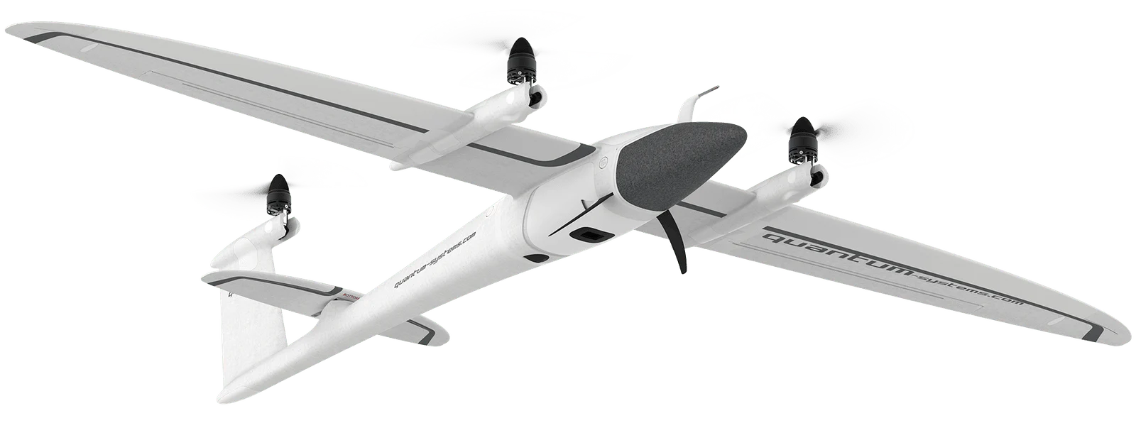
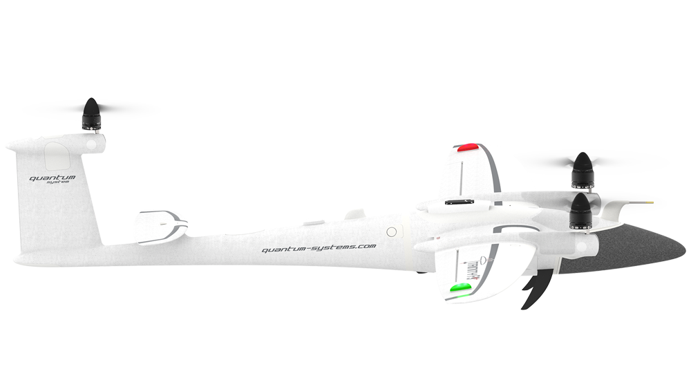
The Quantum Systems Trinity F90+ represents a significant advancement in professional surveying drone technology, combining the convenience of vertical takeoff and landing with the efficiency of fixed-wing flight. This hybrid VTOL platform is specifically engineered for large-scale mapping, surveying, and inspection missions where traditional multirotor drones fall short due to flight time limitations and fixed-wing aircraft are impractical due to space constraints.
Designed for professional surveyors, mapping companies, and enterprise users, the Trinity F90+ addresses the critical need for long-endurance aerial data collection in challenging environments. Its robust construction and advanced flight systems make it suitable for operations in various weather conditions, while its sophisticated sensor integration capabilities ensure high-quality data acquisition for photogrammetry, LiDAR, and specialized inspection tasks.
The platform's unique selling proposition lies in its ability to cover vast areas in a single flight while maintaining the operational flexibility of a VTOL system. This makes it particularly valuable for infrastructure monitoring, environmental surveying, and large-scale mapping projects where efficiency and data quality are paramount.
Key Specifications
- Maximum flight time: 90 minutes
- Maximum range: 60 km (with datalink)
- Cruise speed: 65 km/h (40 mph)
- Maximum speed: 110 km/h (68 mph)
- Maximum payload: 1.2 kg
- Maximum takeoff weight: 4.2 kg
- Wingspan: 1.2 meters
- Operating altitude: Up to 3,000 meters AGL
- Wind resistance: Up to 45 km/h (28 mph)
- IP rating: IP54 (weather resistant)
- GPS accuracy: RTK-enabled with cm-level precision
- Ground sample distance: Down to 1.5 cm/pixel (depending on payload and altitude)
- Supported sensors: RGB cameras, multispectral, thermal, LiDAR
- Communication range: Up to 40 km line of sight
- Operating temperature: -10°C to +50°C
- Autopilot: Advanced flight management system with redundancy
- Launch method: Vertical takeoff, no runway required
- Recovery method: Vertical landing with precision positioning
Pricing & Configuration
The Trinity F90+ follows an enterprise pricing model with costs varying significantly based on configuration, sensor packages, and support requirements. Base system pricing typically starts in the mid-five-figure range, with fully equipped survey-ready configurations reaching six-figure investments. The modular design allows customers to specify sensor packages, ground control systems, and software licenses according to their specific requirements.
Quantum Systems offers comprehensive training programs, extended warranties, and ongoing technical support as part of their enterprise service model. Leasing and rental options are available for short-term projects or organizations evaluating the platform before purchase. The total cost of ownership includes regular maintenance, software updates, and potential component replacements over the system's operational lifetime.
Pros and Cons
Pros:
- Exceptional 90-minute flight endurance enables large area coverage
- VTOL capability eliminates runway requirements and launch equipment
- Professional-grade survey accuracy with RTK GPS integration
- Weather-resistant IP54 rating for reliable operations
- Advanced autopilot with automated mission planning and execution
- Modular sensor integration supports various applications
- Excellent build quality and German engineering standards
- Comprehensive training and support programs
Cons:
- High acquisition cost limits accessibility for smaller organizations
- Complex operation requires extensive pilot training and certification
- Limited payload capacity compared to larger fixed-wing platforms
- Expensive maintenance and ongoing support requirements
- Regulatory compliance complexity in various jurisdictions
- Weather sensitivity despite IP54 rating in extreme conditions
Who Should Buy This Drone?
The Trinity F90+ is ideally suited for established surveying companies, engineering consultancies, and large enterprises requiring regular large-area data collection. Organizations conducting infrastructure inspections, environmental monitoring, mining surveys, or agricultural assessments will find the platform's capabilities well-matched to their needs. Government agencies, research institutions, and utility companies represent the primary target market due to their operational requirements and budget capacity.
The system is particularly valuable for users who regularly survey areas exceeding several hundred hectares, where the Trinity F90+'s extended flight time provides significant operational advantages over multirotor alternatives. Companies with existing drone programs looking to upgrade their capabilities or expand their service offerings will appreciate the platform's advanced features and professional-grade performance.
Final Verdict
The Quantum Systems Trinity F90+ stands as one of the most capable professional survey drones currently available, offering an exceptional combination of flight endurance, operational flexibility, and data quality. While the significant investment required limits its accessibility to well-funded organizations, the platform delivers genuine value for users with appropriate operational requirements. The advanced VTOL capabilities, combined with fixed-wing efficiency, create a unique operational envelope that justifies the premium positioning. For professional users requiring reliable, high-quality aerial data collection over large areas, the Trinity F90+ represents a compelling solution that can significantly enhance operational capabilities and project efficiency.
Pros
- + Exceptional 90-minute flight time
- + VTOL capability eliminates runway requirements
- + Professional-grade survey accuracy with RTK GPS
- + Weather-resistant IP54 rating
- + Advanced autopilot with automated mission planning
Cons
- - High acquisition cost
- - Complex operation requires extensive training
- - Limited payload capacity compared to larger platforms
- - Expensive maintenance and support requirements
Frequently Asked Questions
What is Quantum Systems Trinity F90+?
The Trinity F90+ is a professional VTOL fixed-wing drone designed for large-area surveying and mapping missions. It combines vertical takeoff capabilities with efficient fixed-wing flight, offering up to 90 minutes of flight time and advanced payload integration for photogrammetry and LiDAR applications.
How much does Quantum Systems Trinity F90+ cost?
Quantum Systems Trinity F90+ uses a enterprise pricing model with plans starting at Contact for pricing.
What are the main advantages of Quantum Systems Trinity F90+?
The key advantages of Quantum Systems Trinity F90+ include: Exceptional 90-minute flight time; VTOL capability eliminates runway requirements; Professional-grade survey accuracy with RTK GPS; Weather-resistant IP54 rating; Advanced autopilot with automated mission planning.
What are the drawbacks of Quantum Systems Trinity F90+?
Some limitations to consider: High acquisition cost; Complex operation requires extensive training; Limited payload capacity compared to larger platforms; Expensive maintenance and support requirements.
What category does Quantum Systems Trinity F90+ belong to?
Quantum Systems Trinity F90+ is a Surveying & Mapping tool developed by Quantum Systems.
Surveying & Mapping Guides
Best Drones for Construction Site Surveying in 2026
Best ToolsTop surveying drones for construction professionals. Compare RTK accuracy, BIM integration, volumetric analysis capabilities, and total cost of ownership for site surveys.
How to Choose a Survey Drone: RTK vs PPK vs Standard GPS
How to ChooseA practical guide to understanding RTK, PPK, and standard GPS accuracy for surveying drones. Learn which positioning technology fits your project requirements and budget.
Drone Regulations for Commercial Operators: 2026 Guide
How to ChooseA plain-language guide to commercial drone regulations in the US, EU, UK, and Australia. Covers Part 107, Open/Specific category, BVLOS waivers, and what's changing in 2026.
Other Surveying & Mapping Tools
View all 11 tools →American Robotics Scout System
American Robotics
The American Robotics Scout is a fully autonomous drone system designed for remote monitoring and data collection. It operates without human pilots through an automated base station, enabling continuous surveillance and inspection operations across various industries including energy, agriculture, and security.
Delair UX11
Delair
The Delair UX11 is a professional fixed-wing mapping drone designed for large-scale surveying and GIS applications. It offers exceptional flight endurance up to 59 minutes and can cover up to 450 hectares in a single flight with high-precision mapping capabilities.
DJI Matrice 350 RTK
DJI
Professional enterprise drone platform designed for surveying, mapping, and industrial inspection applications. Features advanced RTK positioning, dual-gimbal capability, and robust flight performance in challenging environments.
DJI Phantom 4 RTK
DJI
A professional mapping drone with integrated RTK positioning system for centimeter-level accuracy surveying and photogrammetry. Features a 20MP camera with 1-inch CMOS sensor and D-RTK 2 high precision GNSS for precise geolocation of captured images.