senseFly eBee TAC
by senseFly
Overview
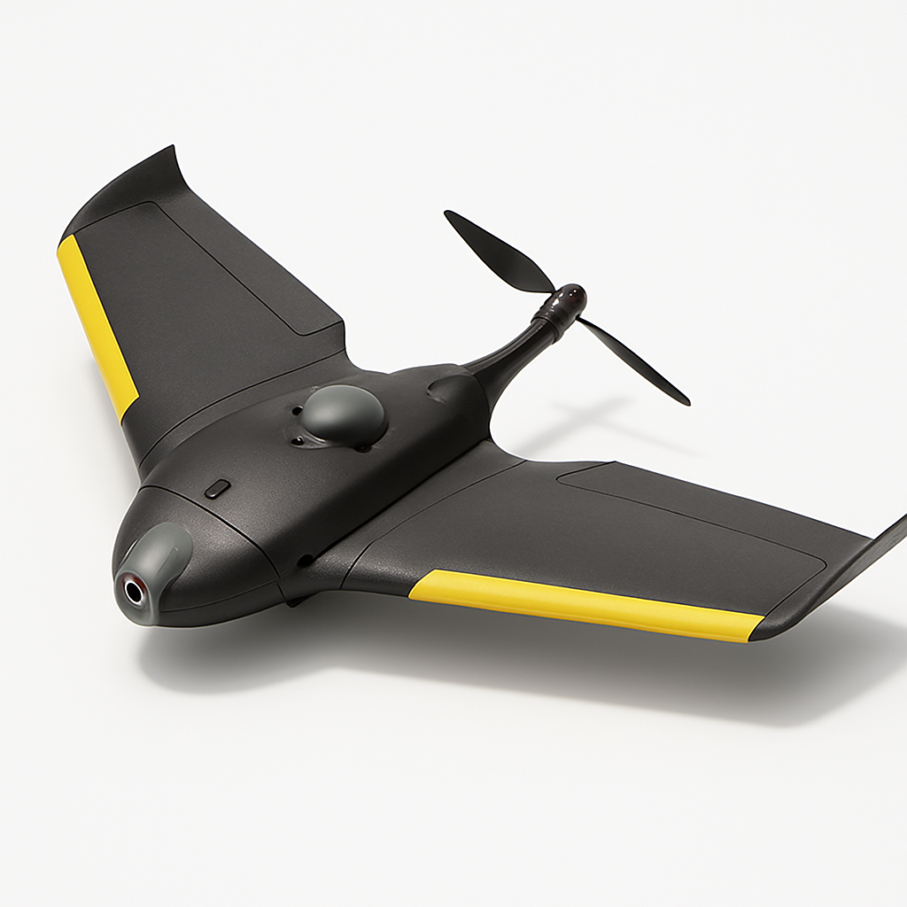
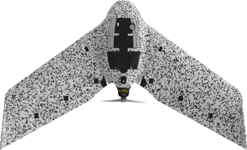
The senseFly eBee TAC represents a specialized evolution of the popular eBee fixed-wing platform, specifically engineered for defense, security, and tactical applications. This professional-grade drone combines the proven reliability of the eBee series with enhanced security features, extended operational capabilities, and ruggedized construction suitable for mission-critical operations.
Designed for military, law enforcement, and security professionals, the eBee TAC excels in reconnaissance, surveillance, search and rescue, and intelligence gathering missions. Its fixed-wing design enables efficient coverage of large areas while maintaining extended flight times that far exceed traditional multirotor platforms. The drone's silent operation and tactical color scheme make it ideal for covert operations where discretion is paramount.
The eBee TAC integrates seamlessly with existing tactical workflows and command structures, offering real-time data transmission and encrypted communications. Its robust construction and ability to operate in challenging environmental conditions make it a reliable tool for operations where failure is not an option.
Key Specifications
- Maximum flight time: Up to 90 minutes
- Operational range: Up to 10 km radius
- Maximum wind resistance: 45 km/h (28 mph)
- Operating temperature: -10°C to +45°C (14°F to 113°F)
- Wingspan: 96 cm (37.8 inches)
- Weight: 700g (1.5 lbs) without payload
- Maximum payload: 150g (5.3 oz)
- Cruise speed: 40-90 km/h (25-56 mph)
- Service ceiling: 4,500m (14,800 ft) above sea level
- Launch method: Hand launch or catapult
- Landing: Belly landing with shock-absorbing foam
- Camera options: RGB, NIR, thermal imaging
- Data transmission: Real-time encrypted link
- GPS accuracy: Sub-meter precision
- Control range: Beyond visual line of sight capable
- Weather resistance: IP54 rating
- Frequency bands: Multiple options depending on region
Pricing & Configuration
The senseFly eBee TAC follows an enterprise pricing model with costs varying significantly based on configuration, payload options, and regional availability. Pricing is not publicly disclosed and requires direct contact with senseFly or authorized tactical/defense distributors. The system typically includes the aircraft, ground control station, necessary software licenses, and basic training.
Configuration options include various sensor packages such as high-resolution RGB cameras, near-infrared sensors for vegetation analysis, and thermal imaging systems for search and rescue or surveillance applications. Additional accessories like ruggedized transport cases, spare batteries, and extended warranty packages are available. Due to the tactical nature of this platform, export restrictions and end-user certificates may be required depending on the destination country and intended use.
Pros and Cons
Extended flight time enables large-area coverage in single missions
Tactical-grade construction withstands harsh operational environments
Silent operation provides stealth capabilities for covert missions
Real-time encrypted data transmission ensures secure communications
Proven fixed-wing platform with extensive field experience
Hand-launch capability requires no additional launch equipment
Multiple sensor options accommodate diverse mission requirements
High acquisition cost limits accessibility for smaller organizations
Complex regulatory requirements and export restrictions
Requires specialized pilot training and certification
Fixed payload capacity limits sensor upgrade options
Weather dependency despite ruggedized construction
Who Should Buy This Drone?
The senseFly eBee TAC is specifically designed for professional users in defense, security, and emergency response sectors. Military units conducting reconnaissance and surveillance operations will find its extended flight time and covert capabilities invaluable. Law enforcement agencies can leverage its real-time intelligence gathering capabilities for search and rescue missions, crime scene documentation, and tactical situations.
Border patrol and customs agencies benefit from its ability to monitor large areas efficiently, while emergency response teams can utilize its thermal imaging capabilities for search and rescue operations. Private security firms working on critical infrastructure protection or large-scale event security may also find value in its capabilities.
This drone is not suitable for recreational users, small businesses, or organizations without dedicated drone operations teams. The complexity of operation, regulatory requirements, and significant investment required make it appropriate only for professional users with specific tactical or security requirements.
Final Verdict
The senseFly eBee TAC delivers exceptional performance for its intended tactical and security applications. Its combination of extended flight time, robust construction, and specialized features creates a compelling platform for professional users who require reliable, long-duration aerial intelligence gathering capabilities. The drone's proven fixed-wing platform provides confidence in mission-critical situations where reliability is paramount.
While the high cost and complex procurement process may be barriers for some organizations, the eBee TAC's specialized capabilities and tactical-grade construction justify the investment for users with appropriate mission requirements. The platform's ability to operate covertly while providing real-time intelligence makes it an valuable asset for defense and security operations. For organizations with the budget and operational need for a tactical-grade fixed-wing drone, the eBee TAC represents one of the most capable options available in the commercial market.
Pros
- + Extended 90-minute flight time
- + Tactical-grade durability and reliability
- + Real-time data transmission capabilities
- + Silent operation for covert missions
- + Advanced encryption and security features
Cons
- - High cost and complex procurement process
- - Requires specialized training and certification
- - Limited payload flexibility compared to multirotor systems
- - Export restrictions may apply
Frequently Asked Questions
What is senseFly eBee TAC?
The senseFly eBee TAC is a tactical fixed-wing drone designed for defense and security applications. It offers extended flight times up to 90 minutes, operates in challenging conditions, and provides real-time intelligence gathering with advanced imaging capabilities.
How much does senseFly eBee TAC cost?
senseFly eBee TAC uses a enterprise pricing model with plans starting at Contact for pricing.
What are the main advantages of senseFly eBee TAC?
The key advantages of senseFly eBee TAC include: Extended 90-minute flight time; Tactical-grade durability and reliability; Real-time data transmission capabilities; Silent operation for covert missions; Advanced encryption and security features.
What are the drawbacks of senseFly eBee TAC?
Some limitations to consider: High cost and complex procurement process; Requires specialized training and certification; Limited payload flexibility compared to multirotor systems; Export restrictions may apply.
What category does senseFly eBee TAC belong to?
senseFly eBee TAC is a Surveying & Mapping tool developed by senseFly.
Surveying & Mapping Guides
Best Drones for Construction Site Surveying in 2026
Best ToolsTop surveying drones for construction professionals. Compare RTK accuracy, BIM integration, volumetric analysis capabilities, and total cost of ownership for site surveys.
How to Choose a Survey Drone: RTK vs PPK vs Standard GPS
How to ChooseA practical guide to understanding RTK, PPK, and standard GPS accuracy for surveying drones. Learn which positioning technology fits your project requirements and budget.
Drone Regulations for Commercial Operators: 2026 Guide
How to ChooseA plain-language guide to commercial drone regulations in the US, EU, UK, and Australia. Covers Part 107, Open/Specific category, BVLOS waivers, and what's changing in 2026.
Other Surveying & Mapping Tools
View all 11 tools →American Robotics Scout System
American Robotics
The American Robotics Scout is a fully autonomous drone system designed for remote monitoring and data collection. It operates without human pilots through an automated base station, enabling continuous surveillance and inspection operations across various industries including energy, agriculture, and security.
Delair UX11
Delair
The Delair UX11 is a professional fixed-wing mapping drone designed for large-scale surveying and GIS applications. It offers exceptional flight endurance up to 59 minutes and can cover up to 450 hectares in a single flight with high-precision mapping capabilities.
DJI Matrice 350 RTK
DJI
Professional enterprise drone platform designed for surveying, mapping, and industrial inspection applications. Features advanced RTK positioning, dual-gimbal capability, and robust flight performance in challenging environments.
DJI Phantom 4 RTK
DJI
A professional mapping drone with integrated RTK positioning system for centimeter-level accuracy surveying and photogrammetry. Features a 20MP camera with 1-inch CMOS sensor and D-RTK 2 high precision GNSS for precise geolocation of captured images.